


Where is the Westernmost Point of Kumamoto Prefecture? Sailing a Vast Expanse of Ocean, I Took a Journey to Find Out Where It Is!
public: 2024.01.17
writer:kese
Japan’s northernmost point is Cape Soya, and its southernmost point is Okinotori Island.
WHERE IS THE EDGE OF KUMAMOTO PREFECTUREーーー!?!? Since I had no idea where it is, my curiosity led me to be off on an adventure to the ends of the earth! I’m gonna be the king of the Kumamoto-edge attainers!
Contents
Let’s Find Out the Westernmost Point of Kumamoto First!
I began by looking up data provided by the “Geospatial Information Authority of Japan,” which is one of the government agencies under the jurisdiction of the “Ministry of Land, Infrastructure, Transport and Tourism.”
Kumamoto Prefecture
| Kumamoto Prefectural Office | The Easternmost Point | The Westernmost Point | The Southernmost Point | The Northernmost Point | |
| Latitude | 130°44′30″ | 131°19′46″ | 129°56′20″ | 130°49′14″ | 131°03′35″ |
| Longitude | 32°47′23″ | 32°49′59″ | 32°10′29″ | 32°05′41″ | 33°11′43″ |
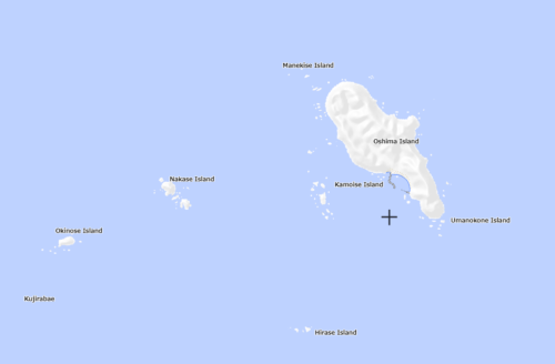
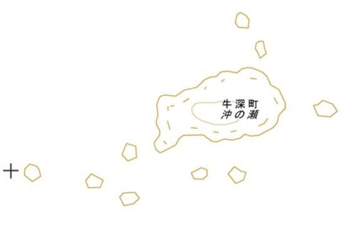
Wow! They provide details on the latitudes and longitudes of Kumamoto prefecture’s boundaries. Much appreciated. So, why don’t we head for the westernmost point this time? Here is the map showing where it is.
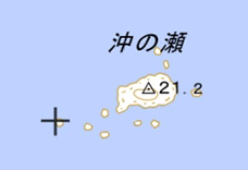
Wait…where’s “Oki no Se”? I’ve lived in Kumamoto for a long time, but I’ve never heard of it
This is the map showing all of the areas of Kumamoto Prefecture. At this level, we can’t find where the place is… Let’s enlarge this map!
We can’t find it yet… And zooming in it a little bit more…
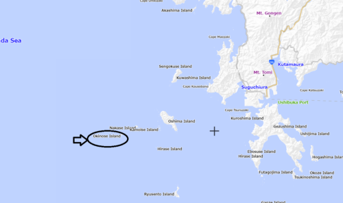
Oh! Here’s the name!!
It looks like it’s situated off the coast of Ushibuka in Amakusa City, but surprisingly, it’s not actually an island.
It’s just a rocky spot in the middle of the sea, making it quite challenging to get to…
Well, hold on a second… Maybe we could reach it by boat!
Now Why Don’t We Go on a Voyage with Rossy?
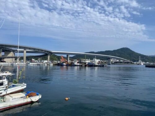
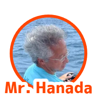
I visited the office of “Tsuribune Rossy (Fishing boat Rossy)” under Ushibuka Haiya-ohashi Bridge in Ushibuka, Amakusa City at 9 a.m.

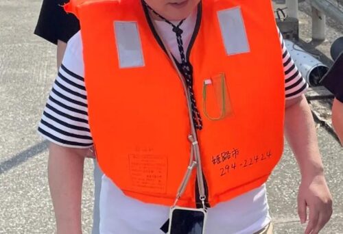
This dashing gentleman, Mr. Hanada from Fishing Boat Rossi, was the one who would fulfill my wish to reach the westernmost point of Kumamoto.
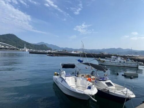
Wow… That is the boat we’re entrusting our lives to…
I’ve just put on a life jacket, and I’m ready for the voyage navigating my way under Ushibuka Haiya-ohashi Bridge and towards the endless open sea! Now, here we go!
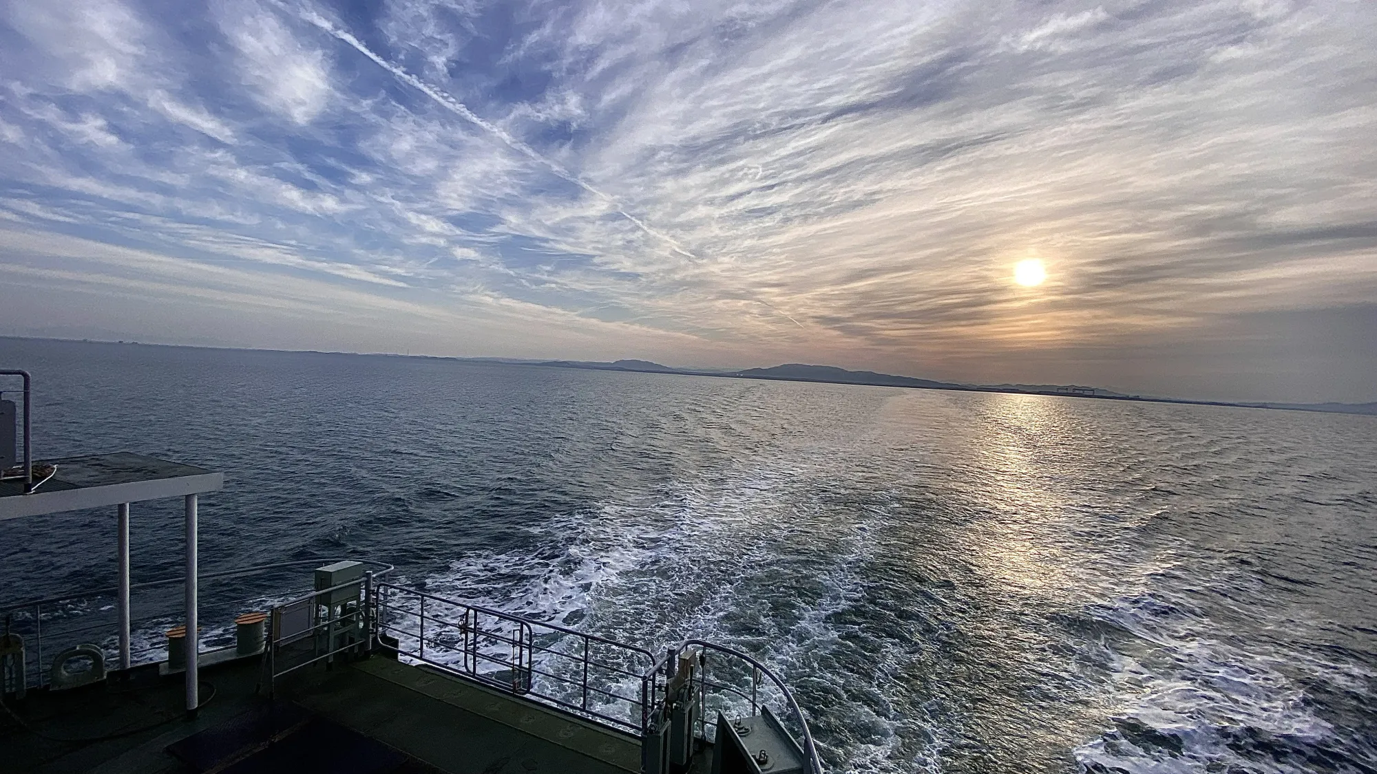
And then, we set sail!
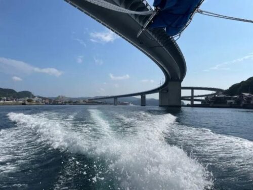
Passing under Haiya Ohashi Bridge, we headed out to the open sea, making a beeline westward as water sprayed around us.
We’ll stop by a spot.
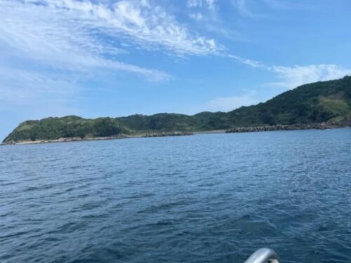
That’s Oshima Island. It used to be inhabited, but now it’s deserted.

I see… But there are some people there!
Actually, people can ask a shipowner to carry them to this island, and enjoy camping or fishing.
Ohshima is the biggest island on the right side of this map, and it takes much more time to reach “Okinose”, which we are heading for.
If you look into the ocean, you’ll definitely be impressed with how transparent its water is!! Apparently, many people enjoy scuba diving here.
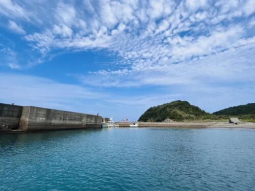
Let’s head to our next spot.
Then, the boat started going even further west.
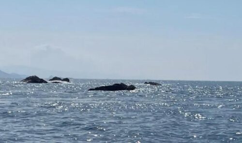
This island is called “Nakase”. I’ll pull up our boat.
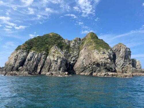
I wonder if the photo captures the sheer intensity of this place. Initially, I thought it was just a tiny rocky spot, but as I got closer, the impact it had on me intensified.
I stumbled upon a lone fisherman on the unsteady ground around the corner. I couldn’t help but wonder why he chose such a rugged place with no shade, especially in this sweltering weather. And to add to the mystery, there were no other boats around except for ours! Then, Mr. Hanada opened his mouth.
Probably, he asked a shipowner to carry him here this morning, and pick him up in the evening. We offer such services.
Wait… what about the restroom…? Dark thoughts start to creep in.. But Mr. Hanada blew away this delusion with his voice.
We are almost there! Let’s go to the westernmost spot!!!
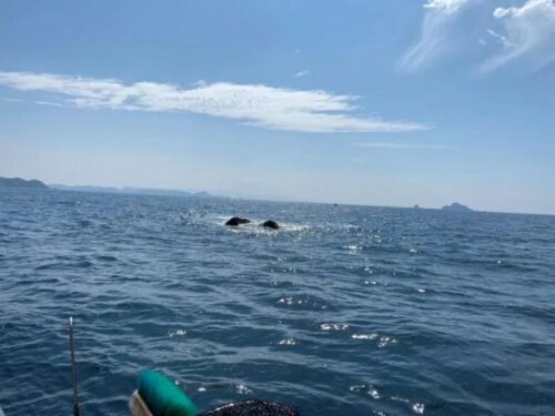
Feeling the grit of the fisherman, we left “Nakase” and kept going for about 5 minutes. Then, we finally arrived at “Okinose”.
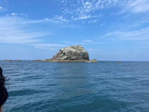
Looking closely, there’s another fisherman. I’m not even surprised anymore.
We’re headed towards a rocky area on the western edge, and we finally arrived after the boat circled the island.
Check it out – we’ve made it to the furthest point west in Kumamoto Prefecture!
That rocky area is the westernmost point of Kumamoto!!! Thank you, Mr. Hanada!!
Actually, there’s one more spot even further west, the true farthest point.
Are you serious!?!?
This Point is Literally the Westernmost in Kumamoto!!
Mr. Hanada guideded me to the unofficial westernmost spot “Kujirabae”. We can’t find its name in Google Maps but we can on the map of Geospatial Information Authority of Japan.
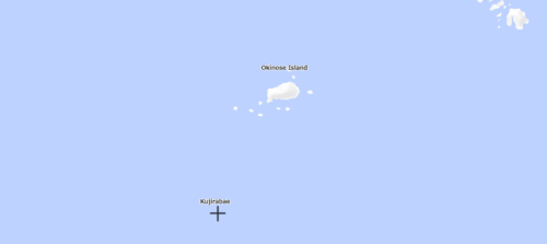
That is the real western wedge, Kujirabae.
According to him, this spot can’t be seen during high tide, so Mr. Hanada decided our departing time to arrive here during low tide.
And what’s more, Mr. Hanada was kind enough to take us on a sightseeing tour of other islands, considering the distance we had traveled! I almost have a crush on him.
Wrapping Up Our Journey
This time, we visited the westernmost place of Kumamoto Prefecture, then found a rocky spot we can see in a limited time and a really kind man loving the ocean.
Wrapped in his kindness and feeling a sense of accomplishment, he extended an invitation for us to join him in fishing, and astonishingly, we caught a blacktip grouper and a bonito in a remarkably short span of time.
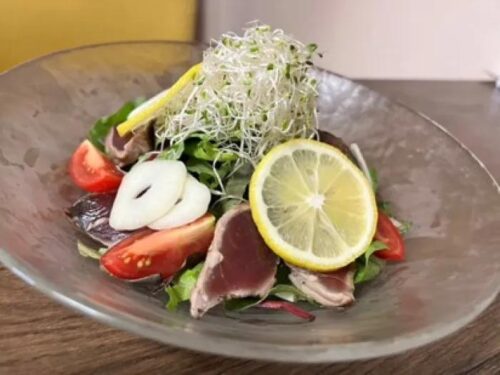
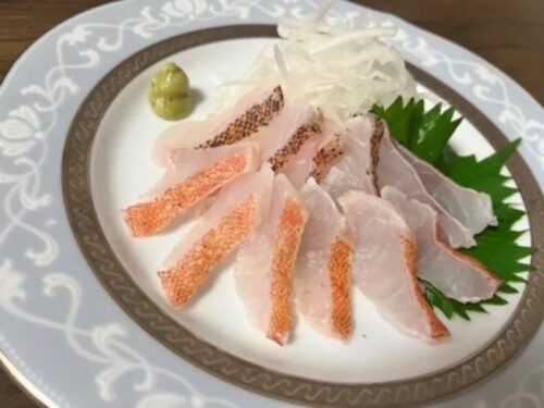
…which were then transformed into sashimi and carpaccio. It’s amazing what unexpected discoveries you can make when you travel to the farthest reaches! Encouraged by this journey, I’m determined to explore every nook and cranny of Kumamoto Prefecture, from east to west, north to south.
Until next time.
TRANSLATOR
kese
I was shocked by Lady Gaga's “Poker Face” in my childhood, fell in love with English songs, and now I am a university student majoring in English. I will do my best to bring you enjoyable English translations!
This writer's other articles.


Related Articles


 Editor's Recommended

PUBLIC RELATIONS PR記事

-
Official SNS
-


SHARE