


There’s No Mountain Called Mount Aso! I Climbed ‘Nekodake’, One Of Aso Gogaku.
public: 2024.02.16
writer:kese
Did you know there’s actually no mountain called ‘Mount Aso’?
‘Mount Aso’ is a collective name for a cluster of peaks that include Nekodake, Takadake, Nakadake, Eboshidake, and Kishimadake. In Japanese they are known as the Aso Gokaku (阿蘇五岳) or the “Five Peaks of Aso”.
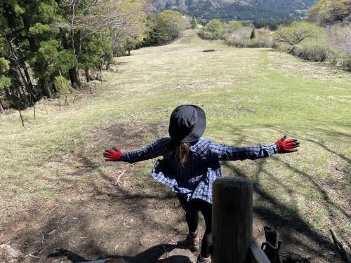
This time, I decided to climb Nekodake, a mountain I usually only gaze up at, with the aim to look down from it!
This is just an article about climbing a mountain. Enjoy it as a little pastime.
Contents
Taking on Nekodake!
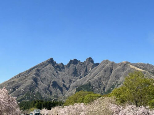
From afar, Nekodake is recognizable by its jagged (somewhat cat-like?) silhouette.
Interestingly, the shape of the Aso Five Peaks is said to resemble Buddha lying on his back, leading to Nekodake being dubbed the facial position of ‘Aso’s Reclining Buddha’ or ‘Aso’s Sleeping Buddha’.
There’s also an urban legend that domestic cats go to Mount Nekodake to train under the ‘Cat King’ residing there.
It’s accessible for hiking from Takamori Town, and the Ooto Ridge route is a perfect day-hike to the summit, achievable in less than two hours one way.
In this journey, we’re heading to Nekodake East Peak via the beginner-friendly Ooto Ridge (大戸尾根, Ōtoone) route.
Even though it’s a day hike, never underestimate the mountain. Proper gear is essential. You’ll need something to drink (about 1 liter), food (lunch or snacks), a compass and map, non-slip shoes (like hiking boots), gloves, and a hat. Mobile phones often get reception, so take yours along. If you’re a first-timer, absolutely go with someone experienced. I can’t stress this enough – underestimating mountains is a big NO.
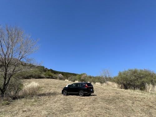
Parking Area
You can start the climb from Takamori Town, and with the parking area well-maintained, you don’t need to worry about finding a place to park your car.
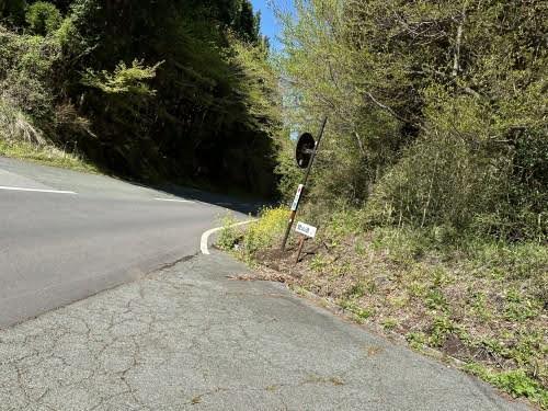
Keep an eye out for signs along the way so you don’t miss them.
The first parking area is near the trailhead, but it’s more of a ‘slope’ than a parking lot.
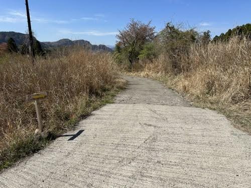
There is also a second parking area. This is the sign pointing towards it.
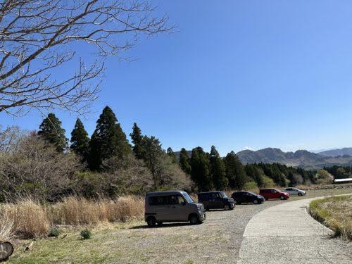
This is the second parking area. There are no restrooms at either parking area, so it’s a good idea to take care of that beforehand.
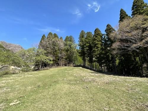
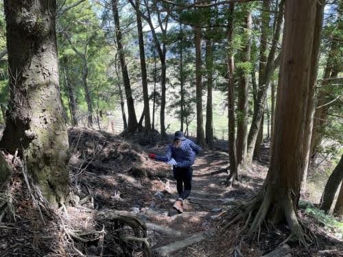
And we begin the ascent!
So, let’s start with some warm-up exercises and begin our walk towards the summit of Nekodake.
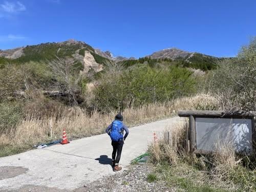
The initial part of the ascent follows a road.
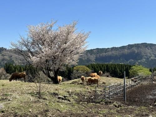
It seemed like the cow was seeing me off as I started my journey.
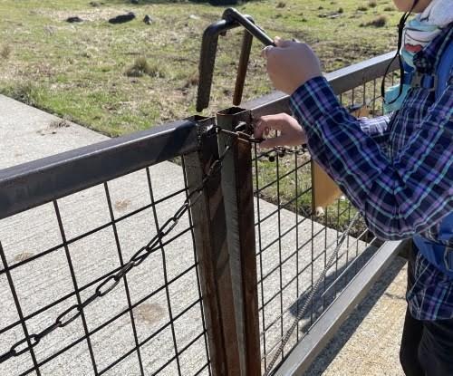
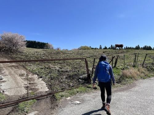
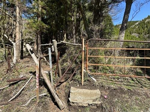
You first pass through a grazing area to get to the trailhead. There’s an iron gate at the entrance to the grazing area.
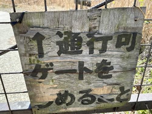
Remember to close the gate behind you; we don’t want the cows wandering off.
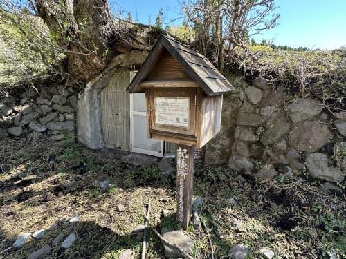
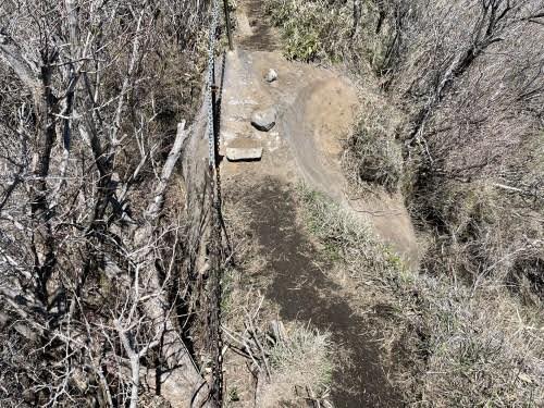
After a while, you’ll come across an emergency shelter and a registration post.
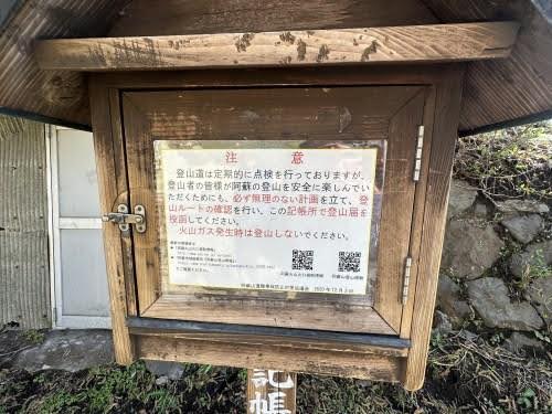
Inside the box, you’ll find a mountain climbing registration form.
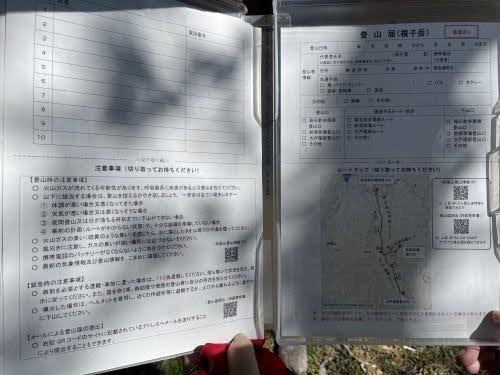
There’s a pen too, so there is no excuse for not filling it out.
Make sure to fill it out before you ascend!
The bottom part of the form can be torn off and used as a map, which is handy.
It’s about 10 AM now. Approximately 2 kilometers to the summit. A round trip of 4 kilometers. I begin my climb, planning to reach the summit around noon.
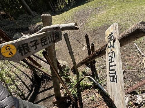
The trailhead lies just beyond this hill. Watch out, there’s a lot of cow dung around.
I arrived at the trailhead.
I duck under and enter.
This part can be a bit tricky to navigate!
Steep Mountain Path
There aren’t many guiding signs in the way, so you’ll climb while looking for paths that people have walked or markers like ribbons.
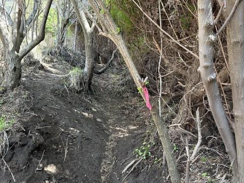
Nekodake is a short but steep climb. It goes without saying, but it is all uphill!
With the Achilles tendon stretched and knees and hamstrings feeling shaky, I make my way up, grabbing onto trees and ropes for support.
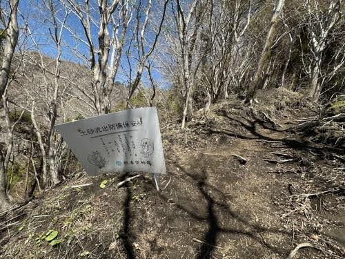
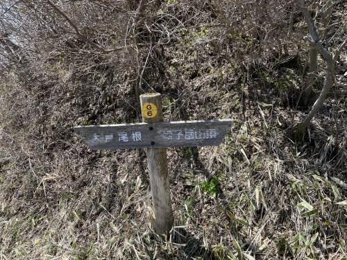
About halfway up, there’s a signboard.
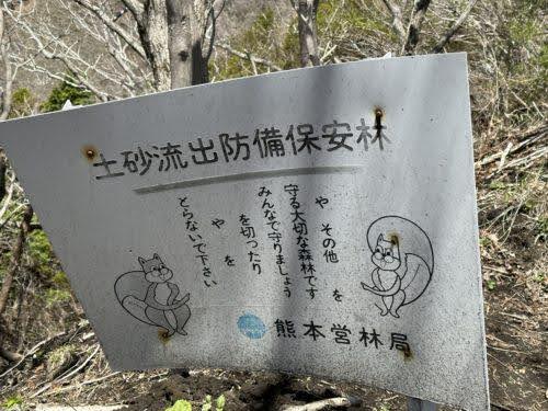
The crucial part is missing. It’s a good spot to take a break and fill in the blanks on this sign for a bit of fun.
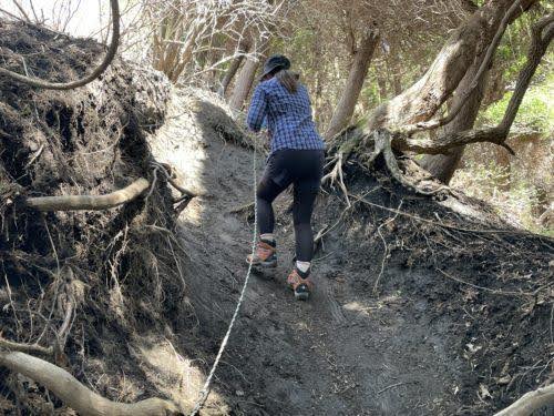
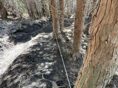
Climbing with the help of ropes like this, I’m grateful to those who maintain the path.
After climbing for a while, the view opens up, and you can see Takamori Town. The summit is still a long way to go.
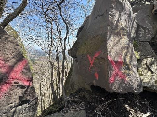
Directions that aren’t part of the trail are clearly marked with a big ‘X’. Make sure to follow the right path.
The direction of the yellow arrow is the correct route. To figure out how to climb, I go closer and…
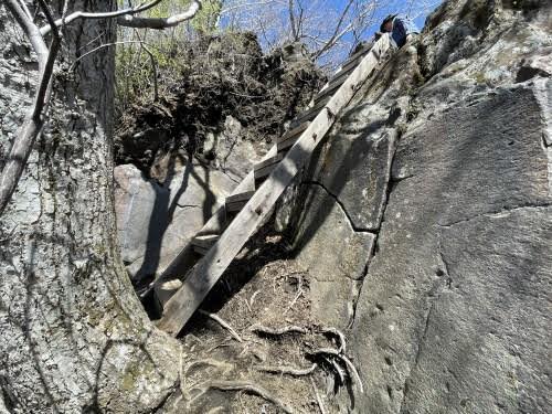
I found a ladder behind the rocks.
Beneath the ladder is a cliff. I’ll climb carefully. It’s been about an hour to get here. I’ll keep looking ahead and move forward.
A piece of advice here: don’t think ‘I’m almost at the summit.’ It always takes longer than you expect. Instead, enjoy the fresh air, the views, the flowers at your feet, and conversations with friends as you walk.
Breathtaking Views Await Those Who Make It This Far.
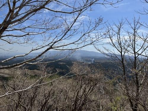
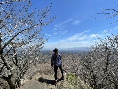
Near the summit, the tall trees disappear, and a stunning view awaits. You can overlook Takamori Town. The sound of motorcycle engines from touring bikes below can be heard even up here.
There are signs to prevent people from going in the wrong direction as they descend. It seems there are other routes too, as I saw people arriving from different directions.
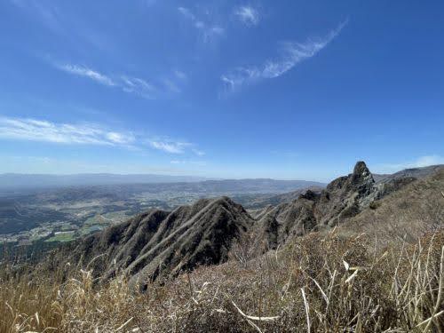
Almost at the summit, just a little more to the jagged part! I think that’s Minamiaso village in the distance.
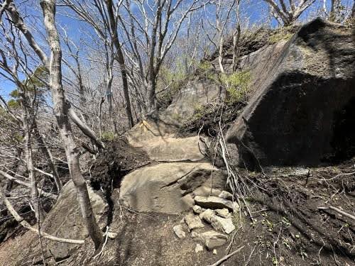
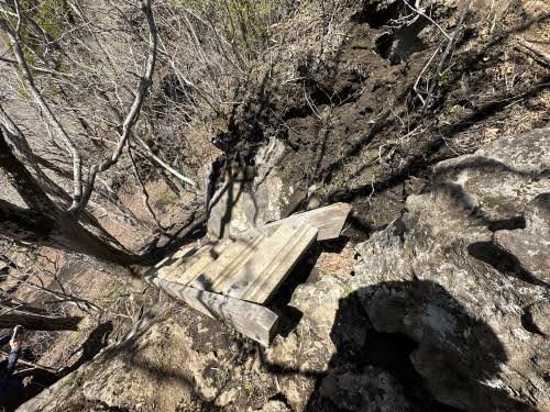
Once you cross this rock, you’ll reach the summit. It’s not immediately obvious, but there are cliffs on both sides. Carefully traverse it using the ropes.
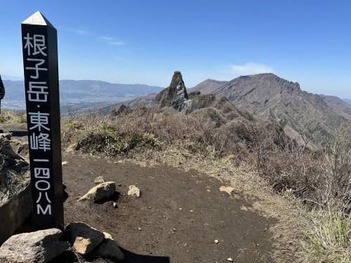
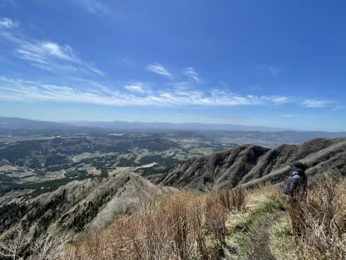
I reached the summit in about 1 hour and 30 minutes. The weather was good that day, and there were around 5 other groups of people there.
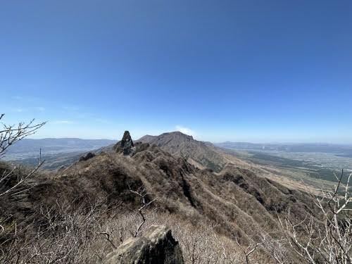
I wonder if the mountain in the distance that seems to have smoke coming from it is Mt. Nakadake. You can overlook the landscape surrounded by the outer rim of the caldera.
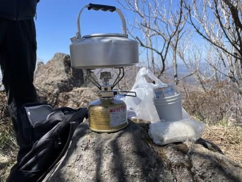
As it was lunchtime, I boiled some water for coffee and had a light snack before descending. Coffee on the summit is exceptional!
Be Careful on Your Way Down!
While climbing was tough on the Achilles tendon, the descent puts constant pressure on the toes.
Don’t let the joy of reaching the summit make you lose focus. 70% of slipping accidents happen on the way down.
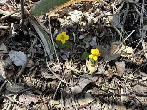
If you carefully observe the slippery ground, you’ll notice newly sprouted trees and small flowers blooming at your feet.
I finished the descent around 2 PM. Including the break at the summit, it was about a 4-hour hike in total. The Five Peaks of Aso offer stunning views that change with the seasons. Thank you for reading my experience of taking on the challenge of climbing Mount Nekodake.
*Please note that the information contained in this article is based on the it was written and may have changed since.
TRANSLATOR
kese
I was shocked by Lady Gaga's “Poker Face” in my childhood, fell in love with English songs, and now I am a university student majoring in English. I will do my best to bring you enjoyable English translations!
This writer's other articles.


Related Articles


 Editor's Recommended


PUBLIC RELATIONS PR記事


-
Official SNS
-


SHARE